Introduction
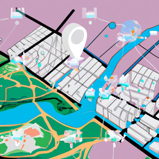
Geospatial technology is the use of computer systems to collect, store, manipulate, analyze, manage, and present spatial or geographic data. It combines technologies such as Global Positioning System (GPS), Geographic Information System (GIS), remote sensing, photogrammetry, cartography, and land surveying to enable users to better understand and visualize the earth’s physical features. Geospatial technology can be used for a variety of purposes, including business, disaster management, environmental monitoring, smart city planning, navigation, public safety, and urban infrastructure management.

Exploring the Benefits of Geospatial Technology in Business
Businesses are increasingly turning to geospatial technology to improve their operations. According to a report by MarketsandMarkets, “the global geospatial analytics market size is projected to grow from USD 22.3 billion in 2020 to USD 42.1 billion by 2025, at a Compound Annual Growth Rate (CAGR) of 13.0%.” Here are some of the ways businesses are leveraging geospatial technology:
Enhancing efficiency and productivity
Geospatial technology can help businesses optimize their processes and increase their efficiency and productivity. For example, businesses can use geospatial technology to track the location of their assets in real-time, reducing the time it takes to locate them. It also enables businesses to plan and manage their resources more effectively, as it allows them to determine the most efficient routes for deliveries and other tasks. As a result, businesses can save time and money.
Streamlining data management
Geospatial technology can also simplify data management by allowing businesses to store, organize, and analyze large amounts of data quickly and easily. This helps businesses make more informed decisions based on accurate data. For instance, businesses can use geospatial technology to identify customer trends and patterns, enabling them to create targeted marketing campaigns that are more likely to succeed.
Improving customer experience
Geospatial technology can also be used to improve the customer experience. For example, businesses can use geospatial technology to provide customers with real-time updates on their orders and locations. This can help reduce customer wait times and increase customer satisfaction. Additionally, businesses can use geospatial technology to create interactive maps and visualizations that can help customers find their way around stores and websites more easily.

Leveraging Geospatial Technology for Disaster Management
Geospatial technology can also be used for disaster management. For example, it can be used to map out areas affected by disasters, such as floods, earthquakes, and wildfires. This helps first responders identify areas of greatest risk and deploy resources more effectively. Additionally, geospatial technology can be utilized to monitor changes in the environment and predict potential disasters.
Facilitating real-time monitoring
Geospatial technology can be used to facilitate real-time monitoring of disasters. With the help of sensors, satellites, and aerial imagery, first responders can track the progress of a disaster in real-time and respond accordingly. This helps minimize the loss of life and property during a disaster.
Enhancing response time
Geospatial technology can also help enhance the response time of first responders. By using GPS and GIS, first responders can quickly and accurately locate victims and deploy resources more effectively. This can help reduce the time it takes to respond to an emergency situation.
Identifying areas of risk
Geospatial technology can also be used to identify areas of high risk. For example, it can be used to map out areas that are prone to flooding or other natural disasters. This helps first responders prepare for potential disasters and take necessary precautions to mitigate the risks.

Using Geospatial Technology for Environmental Monitoring
Geospatial technology can also be used for environmental monitoring. It can be used to track changes in land use, analyze air pollution, and monitor water resources. This helps researchers gain a better understanding of the environment and identify potential issues that need to be addressed.
Tracking changes in land use
Geospatial technology can be used to track changes in land use. For example, it can be used to measure deforestation, agricultural expansion, urban development, and other changes in land use over time. This helps researchers understand how humans are impacting the environment and identify areas that need to be protected.
Analyzing air pollution
Geospatial technology can also be used to analyze air pollution. Remote sensing and satellite imagery can be used to measure levels of particulate matter, ozone, and other pollutants in the atmosphere. This helps researchers identify sources of air pollution and develop strategies to reduce emissions.
Monitoring water resources
Geospatial technology can also be used to monitor water resources. For example, it can be used to measure water levels, detect contamination, and track changes in water quality. This helps researchers understand the health of water resources and identify areas that need to be managed more carefully.
How Geospatial Technology is Used for Smart City Planning
Geospatial technology can also be used for smart city planning. By utilizing GIS and other geospatial technologies, cities can create more efficient and sustainable urban environments. Here are some of the ways cities are leveraging geospatial technology for smart city planning:
Utilizing data to improve decision making
Cities can use geospatial technology to collect and analyze data to inform their decision-making. For example, they can use GIS to map out population density, economic activity, and transportation networks. This helps cities make better decisions about where to invest resources and how to allocate funds.
Creating efficient transportation networks
Geospatial technology can also be used to create efficient transportation networks. For example, cities can use GIS to map out roads, bike lanes, and other transportation routes. This helps cities develop efficient transportation systems that reduce congestion and improve access to essential services.
Developing sustainable energy systems
Geospatial technology can also be used to develop more sustainable energy systems. For example, cities can use GIS to map out solar panels, wind turbines, and other renewable energy sources. This helps cities identify areas with the highest potential for renewable energy and develop effective strategies for implementing them.
Utilizing Geospatial Technology for Improved Navigation
Geospatial technology can also be used for improved navigation. For example, GPS and GIS can be used to create more accurate maps and route planners. This helps users find their way around unfamiliar places more easily and reduces the risk of getting lost.
Increasing accuracy of navigation systems
Geospatial technology can be used to increase the accuracy of navigation systems. For example, GPS and GIS can be used to create detailed maps of streets, buildings, and other features. This helps navigation systems accurately guide users to their destination.
Enhancing situational awareness
Geospatial technology can also be used to enhance situational awareness. For example, GPS and GIS can be used to create real-time maps of traffic conditions, weather patterns, and other factors. This helps users make more informed decisions about when and where to travel.
Facilitating route optimization
Geospatial technology can also be used to facilitate route optimization. For example, GPS and GIS can be used to identify the shortest and most efficient routes. This helps users save time and reduce fuel consumption.

Using Geospatial Technology to Improve Public Safety
Geospatial technology can also be used to improve public safety. For example, it can be used to assist with search and rescue operations, strengthen security of public spaces, and enhance emergency response capabilities.
Assisting with search and rescue operations
Geospatial technology can be used to assist with search and rescue operations. For example, it can be used to map out areas affected by natural disasters, identify areas of high risk, and locate victims. This helps first responders find and rescue victims more quickly.
Strengthening security of public spaces
Geospatial technology can also be used to strengthen the security of public spaces. For example, it can be used to create detailed maps of public areas and track suspicious activities. This helps law enforcement agencies identify potential threats and take appropriate measures to protect citizens.
Enhancing emergency response capabilities
Geospatial technology can also be used to enhance emergency response capabilities. For example, it can be used to facilitate real-time monitoring of disasters, enhance response time, and identify areas of risk. This helps first responders respond to emergencies more quickly and effectively.
Applying Geospatial Technology for Urban Infrastructure Management
Geospatial technology can also be used for urban infrastructure management. For example, it can be used to optimize urban planning, enhance sustainability, and improve quality of life. Here are some of the ways cities are leveraging geospatial technology for urban infrastructure management:
Optimizing urban planning
Cities can use geospatial technology to optimize urban planning. For example, they can use GIS to map out existing infrastructure and identify areas of improvement. This helps cities create more efficient and sustainable urban environments.
Enhancing sustainability
Geospatial technology can also be used to enhance sustainability. For example, it can be used to monitor energy use, track water resources, and identify areas of contamination. This helps cities develop more sustainable solutions to environmental problems.
Improving quality of life
Geospatial technology can also be used to improve quality of life. For example, it can be used to map out parks and recreational areas, identify areas of poverty, and track crime rates. This helps cities identify areas that need to be addressed and develop strategies to improve living conditions.
Conclusion
Geospatial technology has a wide range of applications in various industries, such as business, disaster management, environmental monitoring, smart city planning, navigation, public safety, and urban infrastructure management. This technology can be used to enhance efficiency and productivity, streamline data management, improve customer experience, facilitate real-time monitoring, enhance response time, identify areas of risk, track changes in land use, analyze air pollution, monitor water resources, utilize data to improve decision making, create efficient transportation networks, develop sustainable energy systems, increase accuracy of navigation systems, enhance situational awareness, facilitate route optimization, assist with search and rescue operations, strengthen security of public spaces, enhance emergency response capabilities, optimize urban planning, enhance sustainability, and improve quality of life. As this technology continues to advance, it will become even more integral to our lives.
(Note: Is this article not meeting your expectations? Do you have knowledge or insights to share? Unlock new opportunities and expand your reach by joining our authors team. Click Registration to join us and share your expertise with our readers.)